Bay Area Earthquakes – Current Map & Latest San Francisco Bay Area Quakes
M1.73 7 km ESE of Cloverdale, CA
9 hours ago · Depth 4.1 km
Recent Bay Area Earthquakes (Past 24 Hours)
- M1.737 km ESE of Cloverdale, CA
- M1.738 km ESE of Cloverdale, CA
Source: USGS
The San Francisco Bay Area is one of the most seismically active urban regions in the United States, with earthquake activity linked to a network of active faults including the San Andreas, Hayward, Calaveras, Rodgers Creek, Concord–Green Valley, Greenville, and San Gregorio faults. This page shows the latest Bay Area earthquakes using USGS data, including magnitude, location, depth, and UTC time, so you can track current seismic activity across the region.
Bay Area Earthquake Map
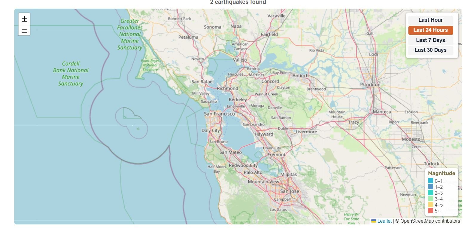
This interactive map shows recent earthquakes of magnitude 1.5+ across the San Francisco Bay Area, including San Francisco, Oakland, San Jose, Berkeley, Fremont, Santa Rosa, Walnut Creek, and surrounding areas. Counts and lists update when the page loads or refreshes. Click any circle to view magnitude, location, time, and depth. Use the time filter buttons to switch between the last hour, 24 hours, 7 days, or 30 days.
Bay Area boundaries are approximate, so earthquakes near the edge of the region may sometimes be included or excluded.
Bay Area earthquakes (map loads with JavaScript)
Magnitude
📊 Bay Area Earthquake Statistics
7 km ESE of Cloverdale, CA
8 km ESE of Cloverdale, CA
8 km ESE of Cloverdale, CA
1 km SE of Boulder Creek, CA
Magnitude 1.5+ • Data from USGS
🔔 Latest Bay Area Earthquakes (M4.0+)
| Mag | Location | Date & Time | Depth |
|---|---|---|---|
| M4.24 | 8 km ESE of Cloverdale, CA | Jul 29, 2026, 2:40 AM UTC | 5.9 km |
Updated: Jul 30, 2026, 8:30 PM UTC
About Bay Area Earthquakes
The Bay Area is earthquake-prone because it sits within the active boundary zone where the Pacific Plate and North American Plate move past one another. Instead of a single fault line, the region is shaped by a broader system of active faults that together accommodate that motion.
The Bay Area is commonly defined as a nine-county region made up of Alameda, Contra Costa, Marin, Napa, San Francisco, San Mateo, Santa Clara, Solano, and Sonoma counties. Because earthquake activity is not limited to one city, a quake in one part of the region can still affect people, transport, and services across the wider region.
Major Faults in the Bay Area
When most people think about Bay Area earthquakes, they think about the San Andreas Fault first, and for obvious reasons. But the Bay Area’s seismic risk comes from a much bigger fault network. USGS identifies seven major fault zones in the region: the San Andreas, Hayward, Calaveras, Rodgers Creek, Concord–Green Valley, Greenville, and San Gregorio faults.
It’s also important to note the presence of blind thrust faults, such as the Mount Diablo Thrust Fault, which do not break the surface but are capable of producing significant earthquakes and contribute to the region’s complex seismic hazard.
Some of these faults run right through, or very close to, heavily populated parts of the Bay Area. The Hayward Fault is a big concern because it cuts through the East Bay, while the Calaveras Fault affects parts of the South Bay and inland East Bay. The San Andreas is the one most people know because of the 1906 San Francisco earthquake, but it is only one piece of a much bigger fault system. That is why earthquake risk in the Bay Area is not just about one city or one fault, it is a regional problem.
Earthquake Risk in the Bay Area
That wider fault network is one reason earthquake planning matters so much here. A widely cited USGS Bay Area forecast estimated a 72% chance of at least one magnitude 6.7 or greater earthquake between 2014 and 2043.
The 2023 National Seismic Hazard Model (NSHM) adds more context by showing the likelihood of damaging earthquake shaking across the United States over a 100-year period. Put simply, a major Bay Area earthquake is not some distant, unlikely scenario. It is a real long-term risk the region needs to be prepared for.
Some faults in the Bay Area also show fault creep, which is slow ground movement that happens without a major earthquake. It has been observed on the Hayward Fault for decades and is also seen on parts of the San Andreas, Calaveras, and Concord–Green Valley faults, which is a reminder that the region’s fault systems are active even when they are not producing a major event.
Historical Major Bay Area Earthquakes
The most famous Bay Area earthquake is still the 1906 San Francisco earthquake, which ruptured about 296 miles (477 km) of the northern San Andreas Fault with an estimated magnitude of 7.9. More than a century later, it is still one of the defining events in California earthquake history.
Another major Bay Area event was the 1868 Hayward earthquake, which is commonly estimated at about magnitude 6.8 to 7.0 and remains one of the most important historical reminders of the hazard on the Hayward Fault.
More recently, the 1989 Loma Prieta earthquake struck on October 17, 1989 at magnitude 6.9, causing widespread damage across the Bay Area and leaving a lasting mark on earthquake planning, retrofits, and public awareness in the region.
How the Bay Area Is Monitored
Bay Area earthquakes are tracked by seismic monitoring networks that detect shaking, locate earthquakes, and measure their size and depth. UC Berkeley’s Seismology Lab operates the Berkeley Digital Seismic Network (BDSN), a regional network of geophysical stations designed to monitor seismic activity across Northern California and provide high-quality data for research and public earthquake information.
That monitoring feeds into public tools including USGS earthquake feeds, seismograms, and ShakeMaps that are used by agencies during response and recovery after significant earthquakes. It is also part of the backbone behind California’s earthquake early warning system, which depends on fast, accurate detection to send alerts before shaking arrives.
Bay Area Earthquake Preparedness
In the Bay Area, earthquake preparedness is not something to put off. USGS and Ready.gov both recommend planning ahead by securing heavy furniture and breakable items, making a household emergency plan, and keeping disaster supplies somewhere easy to reach.
When shaking starts, the standard advice is still Drop, Cover, and Hold On. The California Earthquake Authority and USGS both recommend getting down, protecting your head and neck, and taking cover under a sturdy table or desk if one is nearby.
It is also worth keeping an earthquake kit ready. Useful supplies include water, a first-aid kit, flashlights, a radio, medications, and, where appropriate, tools to shut off utilities. Ready.gov recommends keeping enough basic supplies on hand to get through several days after a disaster.
Bay Area residents can receive earthquake early warnings through Earthquake Warning California. Alerts are available through the MyShake app, Android Earthquake Alerts, and Wireless Emergency Alerts, which can sometimes provide a few seconds of warning before stronger shaking arrives. The MyShake app delivers alerts for earthquakes of magnitude 4.5 or greater.
That may not sound like much, but even a few seconds can make a difference. The goal is not to give people a long countdown. It is to give them just enough time to react and protect themselves before the shaking gets stronger.
Bay Area Fault and Hazard Maps
Fault lines are only part of the picture. Ground conditions matter too. The California Geological Survey and USGS both note that liquefaction can make earthquake damage worse, especially in areas with loose, water-saturated soils. During the 1989 Loma Prieta earthquake, liquefaction played a major role in damage in San Francisco’s Marina District, largely due to the presence of Bay Mud and artificial fill, which significantly amplify shaking and increase liquefaction risk.
For fault and hazard mapping, the California Geological Survey’s EQ Zapp tool lets anyone check whether a specific address or property falls within a mapped earthquake hazard zone. It covers fault rupture zones, liquefaction hazard areas, and earthquake-induced landslide zones across California, including the Bay Area. CGS also makes related hazard data available through its Information Warehouse for more detailed research.
These maps are useful because earthquake risk is not just about fault lines themselves. Knowing whether a neighborhood sits on filled land, bay mud, or solid bedrock can make a significant difference in how strongly shaking is felt and how much damage results.
Did You Feel Shaking?
You can report it through the USGS Did You Feel It? system, which collects public shaking reports after earthquakes and helps improve quake impact information.
Related Earthquake Maps
View California regions: Northern California | Southern California | California
View broader region: United States Earthquakes | North America Earthquakes
More Earthquake Resources
USGS Earthquake Hazards Program | Earthquake Warning California | Ready.gov Earthquakes