California Earthquakes – Current Map & Latest Seismic Activity
M2.81 14 km N of Morgan Hill, CA
3 hours ago · Depth 6.5 km
Recent California Earthquakes (Past 24 Hours)
- M2.3216 km W of Petrolia, CA
- M1.9435 km NNE of Benton, California
- M1.6461 km NNE of Keeler, California
- M1.847 km E of Huron, CA
- M2.8114 km N of Morgan Hill, CA
- M1.925 km S of Banning, CA
- M1.997 km WNW of Little Lake, CA
- M2.0619 km NW of New Idria, CA
- M1.544 km SE of Home Gardens, CA
- M2.118 km NE of Ventura, CA
- M1.5445 km NE of Holtville, CA
- M2.096 km SE of Napa, CA
- M1.711 km NNE of El Centro, CA
- M1.8621 km NW of Alder Springs, CA
- M1.708 km WNW of Laytonville, CA
Source: USGS
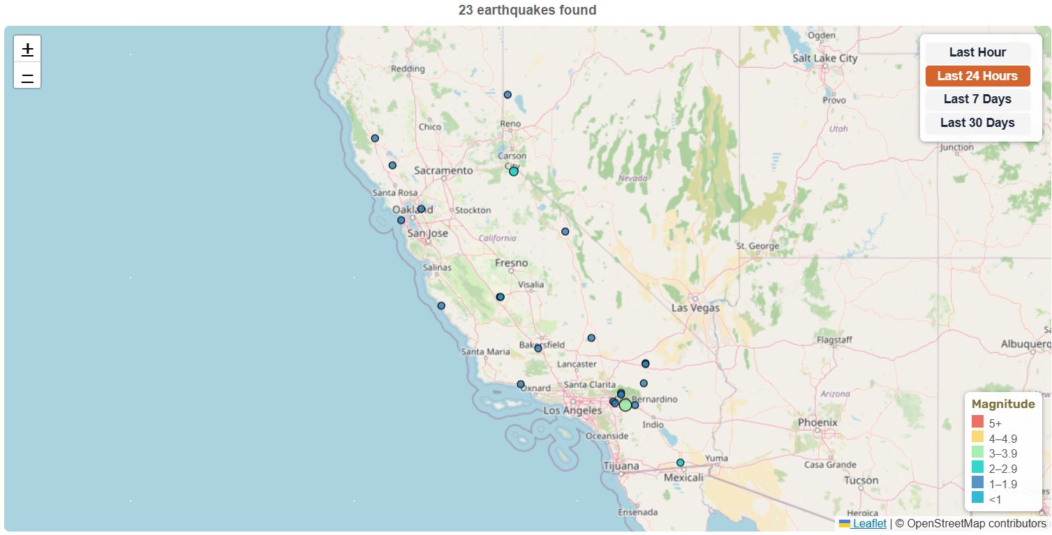
California Earthquake Map
This interactive map shows recent earthquakes in California using USGS earthquake data. Each colored circle represents an earthquake location. Click any circle to see detailed information including magnitude, location, time, and depth. Use the time filter buttons to view earthquakes from the last hour, 24 hours, 7 days, or 30 days. Counts and map data update when the page is refreshed.
California earthquakes (map loads with JavaScript)
Note: This page updates on refresh. For the latest earthquake counts and statistics, please refresh the page.
📊 California Earthquake Statistics
4 km SE of Loma Linda, CA
10 km NNE of Cabazon, CA
1 km SE of Boulder Creek, CA
20 km NNE of Indio, CA
Magnitude 1.5+ • Data from USGS
These statistics update automatically using real-time earthquake data from the U.S. Geological Survey (USGS).
🔔 Latest California Earthquakes (M4.0+)
| Mag | Location | Date & Time | Depth |
|---|---|---|---|
| M4.59 | 1 km SE of Boulder Creek, CA | Apr 2, 2026 8:41 AM UTC | 10.4 km |
Updated: May 1, 2026, 1:59 AM UTC
On average, two or three earthquakes every year in California reach magnitude 5.5 or higher—powerful enough to damage buildings and infrastructure.
Source: California Geological Survey (CGS)
About California Earthquakes
California experiences thousands of earthquakes each year due to its location along the Pacific Ring of Fire and the boundary between the Pacific and North American tectonic plates. The San Andreas Fault system, stretching approximately 800 miles (1300 km) through California, is one of the world’s most studied and monitored fault systems.
Major Fault Systems
- San Andreas Fault: Major transform fault system running through much of California; large scenarios include a USGS M7.8 southern San Andreas earthquake, while computer models suggest the wider San Andreas Fault system could produce earthquakes up to about M8.3.
- Hayward Fault: East Bay fault through heavily populated areas, considered one of the most dangerous in California
- Calaveras Fault: Parallel to Hayward Fault, runs through Hollister and San Jose areas
- San Jacinto Fault: Southern California fault zone, one of most active in the state
- Garlock Fault: East-west trending fault in southern California, separates Mojave Desert from Sierra Nevada
- Cascadia Subduction Zone: Offshore Northern California and the Pacific Northwest; capable of rare M9-class megathrust earthquakes and tsunamis.
- Elsinore Fault Zone: Major Southern California fault zone running through parts of San Diego, Riverside, and Orange County regions.

Source: U.S. Geological Survey (USGS) Public Domain
Seismically Active Regions
- Bay Area: San Francisco, Oakland, San Jose are crisscrossed by multiple active faults
- Los Angeles Basin: Complex network of faults including Newport-Inglewood and Hollywood faults
- Eastern Sierra: High seismic activity along eastern edge of Sierra Nevada
- Imperial Valley: Southern California near Mexican border, frequent seismic activity
- North Coast: Mendocino Triple Junction where three tectonic plates meet
Earthquake Risk & Probabilities in California
According to the USGS, California has a high probability of experiencing damaging earthquakes in the coming decades:
- San Francisco Bay Region: about a 72% chance of at least one M6.7 or larger earthquake between 2014 and 2043, according to the USGS UCERF3 forecast.
- Southern San Andreas: capable of M7.8 with major surface rupture.
- Cascadia Subduction Zone: capable of M9 megathrust earthquakes offshore Northern California.
Source: USGS – “Most California earthquakes occur within the top 16 km (10 miles)…”
Historical Major Earthquakes
- 1857 Fort Tejon (M7.9): Left a 220-mile surface scar
- 1906 San Francisco (M7.9): Major San Andreas Fault earthquake followed by devastating fires that destroyed much of San Francisco
- 1989 Loma Prieta (M6.9): World Series earthquake, collapsed section of Bay Bridge
- 1994 Northridge (M6.7): Los Angeles area, one of costliest earthquakes in US history
- 2019 Ridgecrest (M7.1): Eastern California near Death Valley, largest in 20 years
Earthquake Preparedness
California has strong seismic building standards and a statewide earthquake early-warning system. ShakeAlert is the USGS-managed detection system, while public alerts are delivered through tools such as the MyShake App, Android Earthquake Alerts, and Wireless Emergency Alerts. These alerts may provide valuable seconds of warning before shaking arrives, giving people time to Drop, Cover, and Hold On. All California residents should have emergency kits and family disaster plans.
Earthquake Safety Checklist
- Keep a 3-day supply of food, water, and medications
- Secure heavy furniture and appliances
- Know “Drop, Cover, and Hold On” procedures
- Download the MyShake App and make sure Wireless Emergency Alerts are enabled on your phone. Android users can also enable Android Earthquake Alerts.
- Have an out-of-area emergency contact
Source: USGS – Cascadia Subduction Zone Science
California’s Earthquake Monitoring Networks
California’s earthquake monitoring data comes from several scientific networks working together:
- USGS Earthquake Hazards Program – national seismic monitoring and hazard assessment.
- Southern California Seismic Network (SCSN) – operates 500+ stations across Southern California.
- Caltech Seismological Laboratory – analyzes regional seismicity and supports ShakeAlert.
- California Geological Survey (CGS) – provides fault maps and seismic hazard zoning.
Frequently Asked Questions
Why does California have so many earthquakes?
Because it lies along the boundary between the Pacific and North American plates, crossed by numerous active faults such as the San Andreas.
What was the largest earthquake in California?
The largest earthquakes in California were the 1857 Fort Tejon and 1906 San Francisco events, both estimated at magnitude 7.9. The 1906 quake was the most destructive, devastating San Francisco and killing over 3,000 people.
Does California have an early-warning system?
Yes. ShakeAlert is the USGS-managed detection system, while public alerts are delivered through tools such as the MyShake App, Android Earthquake Alerts, and Wireless Emergency Alerts.
Which part of California has the highest earthquake risk?
The San Francisco Bay Region and Southern California’s major fault zones are among the areas with the highest concern for damaging earthquakes in the coming decades, according to USGS earthquake forecasts and hazard information.
🗺️ Related Maps
View broader region: United States Earthquakes
View other states: Alaska | Washington
View California regions: Southern California | Northern California | San Francisco Bay Area
Note: Regional earthquake boundaries are approximate. Some earthquakes near regional edges may appear on more than one California regional page.
More resources: See all U.S. earthquakes | Earthquake Warning California | USGS Earthquake Hazards Program